Applications

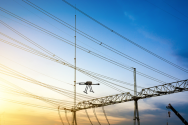
Harnessing the latest in aerial technology, Dronevation’s drone-based powerline inspection service offers a transformative approach to infrastructure management. With precision, efficiency, and safety at the forefront, we’re redefining how power utilities maintain and monitor their critical assets.

Why Choose Drone based Powerline Inspection?

Traditional methods of powerline inspection often entail high costs, safety risks, and time-consuming processes. Our drone-based solution addresses these challenges head-on, offering numerous advantages:
  1. Enhanced Safety: By minimizing the need for manual inspections conducted in hazardous environments, our drone technology ensures the safety of both personnel and the public.
  2. Unrivaled Efficiency: Drones equipped with advanced sensors and cameras can cover extensive areas quickly and accurately, significantly reducing inspection time and costs.
  3. Detailed Data Collection: Our drones capture high-resolution imagery and comprehensive data, allowing for detailed analysis and identification of potential issues before they escalate.
  4. Remote Accessibility: With the ability to navigate challenging terrain and access remote locations, our drones provide unparalleled visibility into powerline infrastructure.

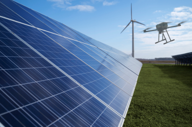
Experience the future of solar panel maintenance with Dronevation’s innovative drone-based inspection solutions. We’re pioneering a smarter, more efficient approach to solar farm management, offering unparalleled precision, speed, and cost-effectiveness.

Why Choose Drone Inspection for Solar Panels?

Traditional methods of solar panel inspection often involve manual labor, lengthy processes, and limited accessibility. Dronevation’s drone technology overcomes these challenges, delivering a host of benefits:
  1. Rapid Inspection: Our drones equipped with high-resolution cameras can quickly cover large solar arrays, reducing inspection time and minimizing operational disruptions.
  2. Detailed Analysis: Dronevation’s drones capture precise imagery and data, allowing for in-depth analysis of individual panels, identifying defects, soiling, or damage with exceptional accuracy.
  3. Enhanced Safety: By eliminating the need for manual inspections conducted at heights, our drone-based approach enhances safety for personnel and minimizes the risk of accidents.
  1. Cost Savings: With faster inspections and reduced labor requirements, Dronevation’s drone solutions offer significant cost savings compared to traditional methods.

Unlock the power of aerial mapping with Dronevation’s cutting-edge drone technology. Dronevation’s offer comprehensive drone mapping solutions that provide accurate, detailed, and up-to-date spatial data for a wide range of applications.

Why Choose Drone Mapping?

Traditional mapping methods often involve time-consuming processes, limited accessibility, and significant costs. Dronevation’s drone solutions offer a more efficient and cost-effective alternative, delivering numerous benefits:
  1. High Precision: Our drones are equipped with advanced sensors and cameras capable of capturing high-resolution imagery with exceptional accuracy, allowing for precise mapping and analysis.

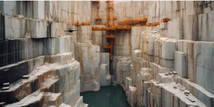
Discover the future of mining operations with Dronevation’s cutting-edge drone technology. Dronevation provide innovative solutions that revolutionize the way mining companies monitor, manage, and optimize their operations, offering unparalleled efficiency, safety, and productivity.

Why Choose Drone-Based Mining Solutions?

Traditional mining operations often face challenges such as safety risks, time-consuming processes, and limited accessibility. Dronevation’s drone solutions address these challenges head-on, delivering numerous benefits:

  1. Enhanced Safety: By minimizing the need for manual inspections in hazardous environments, our drone-based approach improves safety for personnel and reduces the risk of accidents.
  2. Efficient Data Collection: Our drones equipped with advanced sensors and cameras can quickly cover vast mining sites, collecting high-resolution imagery and data with exceptional accuracy, reducing inspection time and operational downtime.
  3. Optimized Operations: With real-time monitoring capabilities, our drones provide valuable insights into mining operations, allowing for better decision-making, improved resource allocation, and enhanced productivity.
  4. Cost Savings: By streamlining inspection processes and reducing the need for costly equipment and manpower, our drone solutions offer significant cost savings compared to traditional methods, increasing profitability for mining companies.


Our Drone-Based Mining Solutions

  1. Site Mapping and Surveying: Our drones conduct aerial surveys to create detailed maps of mining sites, providing accurate topographic data for planning, design, and infrastructure development.
  2. Stockpile Management: Using advanced photogrammetry techniques, our drones measure and monitor stockpiles of raw materials, ensuring accurate inventory management and efficient resource utilization.
  3. Environmental Monitoring: Dronevation’s drones are equipped with specialized sensors to assess environmental factors such as air quality, water contamination, and vegetation health, helping mining companies mitigate environmental impacts and comply with regulatory requirements.

Experience the Future of Mining with Dronevation!!

At Dronevation, we’re committed to leveraging drone technology to drive innovation and sustainability in the mining industry. With our drone-based solutions, you can optimize your operations, improve safety, and maximize the value of your mining assets.

Enhance your security and monitoring capabilities with Dronevation’s advanced drone surveillance solutions. Dronevation provide comprehensive aerial surveillance services tailored to meet the unique needs of various industries and applications.

Why Choose Drone Surveillance?

Traditional surveillance methods may have limitations in coverage, accessibility, and flexibility. Dronevation’s drone solutions offer a more dynamic and versatile approach, providing numerous advantages:

  1. Flexibility: Our drones can be deployed quickly and easily to monitor a wide range of environments, including remote or hard-to-reach areas where traditional surveillance methods may be impractical.
  2. Real-Time Monitoring: With live video streaming capabilities, our drones offer real-time situational awareness, allowing for rapid response to security threats or emergencies.
  3. Cost-Effectiveness: Compared to manned aircraft or ground-based surveillance teams, drone surveillance is often more cost-effective, offering significant savings in operational expenses.
  4. Stealth and Discretion: Drones can operate discreetly and quietly, making them ideal for covert surveillance operations where maintaining a low profile is essential.


Our Surveillance Solutions

  1. Security Patrols: Our drones can conduct routine patrols to monitor perimeters, facilities, or assets, providing continuous surveillance and early detection of security breaches or unauthorized activities.
  2. Event Monitoring: Whether it’s a large-scale event, construction site, or public gathering, our drones can provide aerial coverage to monitor crowds, traffic, and security perimeters in real-time.

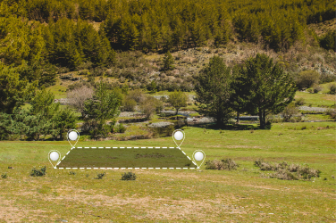
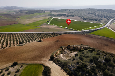
Unlock the potential of precision land surveying with Dronevation’s cutting-edge drone solutions. Our technology revolutionizes the traditional surveying methods, providing a more efficient, accurate, and cost-effective approach to land management.

Why Choose Drone Surveying for Land Management?

Traditional land surveying methods can be time-consuming, labor-intensive, and often limited by accessibility challenges. Dronevation’s drone technology transforms these processes, offering numerous advantages:

  1. Rapid Data Collection: Our drones can swiftly cover vast areas, collecting comprehensive data in a fraction of the time required by traditional methods.
  2. High-Resolution Mapping: Equipped with advanced sensors and cameras, our drones capture high-resolution imagery and generate precise topographical maps, ensuring detailed and accurate results.
  3. Accessibility: Drone-based surveys can easily access hard-to-reach areas, such as rugged terrains and remote locations, without compromising on data quality.
  4. Safety: By eliminating the need for personnel to navigate hazardous environments, our drone solutions enhance safety and reduce the risk of accidents during surveying operations.
  5. Cost Efficiency: With faster data collection and reduced labor costs, Dronevation’s drone surveying solutions offer substantial savings over traditional surveying methods.
  6. Real-Time Data: Our drones provide real-time data transmission, enabling immediate analysis and decision-making for land management projects.